Scientific investigation continues at Durupinar site in Turkey
Researchers are analyzing soil samples from the Durupinar formation to verify claims regarding the potential discovery of Noah's Ark.
Selin Ateş ·
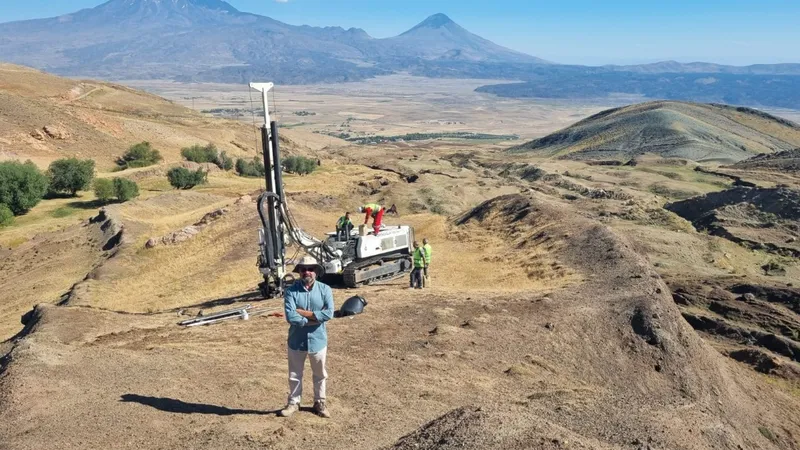
Ongoing geological assessment
A multinational team of twenty experts is currently evaluating data collected from the Durupinar formation, located in the Dogubayazit district of Agri. This investigation follows a three-month intensive field study aimed at determining the geological nature of the site. Researchers have gathered 366 soil and rock samples from both the interior and exterior of the formation for laboratory testing.
The scientific team expects the comprehensive analysis of these samples to conclude within the next two to three months. In addition to chemical testing, the group is utilizing ground-penetrating radar and drilling techniques to create a detailed map of the subsurface layers. These efforts are intended to provide a clearer picture of the structure's composition.
Clarifying recent claims
Project lead Professor Cenker Atila addressed recent online speculation suggesting that the vessel has been definitively located. He emphasized that such assertions are premature, noting that scientific verification requires conclusive laboratory results rather than anecdotal evidence. Atila cautioned against the spread of misinformation regarding the status of the project.
While acknowledging that some team members and local observers are convinced of the site's historical significance, Atila maintained that the project must rely on empirical data. He noted that the team has identified organic materials that increase the likelihood of the site being linked to historical accounts. Furthermore, he pointed out that the dimensions of the formation align with descriptions found in ancient texts, though he reiterated that formal confirmation remains pending.
Historical context of the site
The interest in the Durupinar formation dates back to 1959, when Turkish pilot Ilhan Durupinar identified the unusual geological feature during a NATO aerial mapping mission. Following his report to the Ministry of National Defense, the renowned photographer Ara Guler was commissioned in 1960 to document the area. These early images brought international attention to the region and sparked decades of academic and amateur investigation.
The persistent focus on this location is largely driven by references in religious texts that place the resting place of the vessel within the Ararat mountain range. Since the mid-20th century, this connection has fueled continuous efforts to determine whether the formation is a natural geological phenomenon or a man-made structure. The current study represents the latest attempt to resolve this long-standing inquiry through modern scientific methodology.